Ocean antenna
Water-tight satellite positioning antennas (GPS / Beidou / GLONASS), Beidou short message transmission, communication (Iridium / Maritime Satellite), radio frequency / data transmission (Wi-Fi / Bluetooth / 4G/5G), integration (multi-system integration), customization, etc. Marine antennas


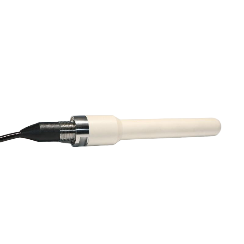
Multi-Band Subsea 4G Antenna with GPS, for Offshore Navigation & Seabed Topography Mapping
Multi-Band Subsea 4G Antenna with GPS, for Offshore Navigation & Seabed Topography Mapping
The GPS system of the deep-sea multi-frequency 4G antenna can provide position, speed and time information for the carrier in any location on land, sea and air in an all-weather, fully automatic, rapid and continuous manner with high accuracy. GPS technology has been widely applied in marine measurement. Carrier phase and differential techniques are used for dynamic water depth measurement, and various scale water depth maps, seabed topography maps and other basic maps are drawn; GPS altimetry data is applied to determine the marine geoid level, etc. At present, various equipment or systems that apply GPS technology to marine measurement are being increasingly put into use, thereby greatly improving the level and efficiency of marine measurement technology.
Couldn't load pickup availability
Product features
Product features
Deep-sea water-resistant, multi-mode compatible, high sensitivity, corrosion-resistant, integrated, suitable for various extreme marine environments.
Materials and care
Materials and care
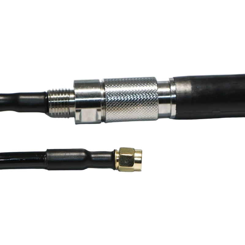
Brass Gold Plating,Polymer material PEEK,Bronze C36000, stainless steel 316L, titanium alloy TC4, hard anodized aluminum 7075, neoprene rubber, polyether type TPU
Customization options
Customization options
Customization is available for all
Share